A family has owned a rural property for three generations. Now it has to sort out three things at once. Dividing the land among the heirs, but the land registry is asking for something called georeferencing. Financing the next harvest, and the cooperative is asking for a technical project. And deciding what to do with the old dam on the stream, which has started seeping water at the toe of the embankment.
These are three different problems, and all three are engineering problems. In this last episode of the series, you will see how engineering works in the countryside.
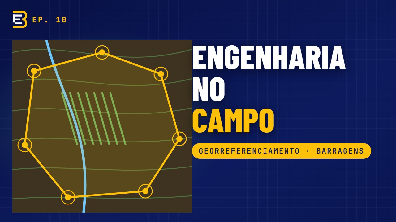
Georeferencing and INCRA
For a long time, rural properties were described in title records with references such as "up to the big rock", "along the neighbour's fence" or "following the stream". Over time, fences move, the rock disappears and the stream changes course. The result is overlaps, differences in area and conflicts between neighbours.
To solve this, the federal law that created the National Rural Property Register (Law 10.267/2001) began to require that the boundaries of rural properties be described by coordinates, tied to the official Brazilian geodetic system, with the precision set by INCRA. That is georeferencing.
And when is it required? In situations such as subdivision, parcelling, merging and transfer of the property, by sale, donation or inheritance, among others. The deadlines were staggered according to the size of the area, and smaller properties were the last to come under the requirement. So it is worth confirming the situation of your property before any deal.
How is the work done?
- Document research: the title record, the adjoining owners and the property's history.
- Field work: the professional walks the perimeter and measures each vertex with high-precision satellite receivers.
- Processing and technical documents: the plan and the specification report with the coordinates of each vertex.
- Certification: this information is sent to SIGEF, INCRA's land management system, by an accredited professional. The system checks that the polygon does not overlap other certified properties. If all is well, the property receives certification. With it, the land registry updates the description on the title record.
A sensitive point is that of the adjoining owners. The boundaries must be acknowledged by the neighbours, and this is where careful field work and good conversation prevent conflicts and delays.
In the end, the family has something valuable: certainty about where its land begins and ends.
Drone: the farm from above
On large properties, the drone has become a great ally. With planned flights, it generates the orthomosaic, an aerial image at the correct scale, and the digital terrain model, which shows the relief in detail.
With these, you can measure areas of crops and pasture, plan internal roads and terraces, calculate volumes of stockpiles or excavations, follow construction work and inspect warehouse roofs, structures and dams without putting anyone at risk.
One note: for INCRA certification, the vertices are measured with satellite receivers in the field. The drone complements this, and a great deal, but does not replace that measurement. And every operation follows the civil aviation rules for drones.
Rural credit and working capital
The family's second question was financing the harvest. Rural credit has lines for working capital, which finances the expenses of a production cycle, such as seed, fertilizer, pesticides and operations, and lines for investment, which finance structures such as sheds, corrals, irrigation, storage and dams.
Banks and cooperatives ask for technical documents to analyse and release these credits. Depending on the operation, these include the technical project or budget, with a description of the activity, the areas, quantities and costs, the schedule, and the identification of the financed area by geographic coordinates.
In investment financing, there are also the designs for the structures to be built and monitoring of the execution, so that instalments are released as work progresses, much as happens in construction financing.
A well-made technical project speeds up credit analysis and reduces back-and-forth over requirements. It also helps the producer plan the harvest with numbers.
Earth dams
The third question was the dam. Small earth dams are very common on rural properties, for irrigation, watering livestock and raising fish. Many were built decades ago, without a design, and have never been inspected.
An earth dam gives signs before it has serious problems. The main ones are:
- water seeping at the toe of the embankment or on the slopes, especially if it comes out cloudy, carrying soil, which may indicate internal erosion;
- cracks and subsidence on the crest or the slopes;
- slides and erosion;
- large trees growing on the embankment, whose roots open paths for water;
- animal burrows;
- a small, blocked or damaged spillway that cannot cope with the water in heavy rain.
When water passes over the top of the dam, the embankment can fail quickly.
The inspection goes over the dam systematically: the crest, the upstream and downstream slopes, the toe, the abutments, the spillway and the outlet structures. Each anomaly is recorded, photographed and classified, and the drone is a great help at this stage.
The result is a report on the condition of the dam with recommendations, from the simplest, such as clearing the spillway and removing vegetation, to the most important, such as restoring a stretch of the embankment or enlarging the spillway.
Larger or higher-risk dams are subject to the National Dam Safety Policy (Federal Law 12.334), with specific obligations. But even for small dams, which fall outside that policy, inspection is the cheapest way to avoid a failure, which can cause losses for the farm itself and for those downstream. And remember: water use in Minas Gerais depends on regularization with the water resources agency.
Biodigester: from manure to biogas
Now, a solution that turns a problem into a resource. In pig and dairy farming, manure is a major environmental challenge: bad smells, flies and the risk of contaminating water and soil.
A biodigester is a closed reactor in which this manure decomposes without oxygen. Two products come out of this process:
- biogas, rich in methane, which can be used for heating, for drying or to generate electricity on the property;
- biofertilizer, a stabilized effluent that can go back onto crops and pasture as fertilizer, following the appropriate agronomic recommendations.
The design sizes the biodigester from the amount of manure produced per day, the time the material needs to stay in the reactor and the conditions of the site. It also defines the most suitable model, the piping, how the gas is flared or used safely, the storage of the biofertilizer and the operating precautions.
Well designed, a biodigester reduces environmental impact, helps in licensing the activity and can also lower the energy bill.
What the rural property is worth
And to close the family's case: once georeferenced, the property can be valued precisely, separating bare land, improvements and crops, as shown in episode 7. It is the basis for a fair division among the heirs.
Common mistakes
- Selling or dividing land without checking the georeferencing requirement.
- Leaving the technical credit project until the eve of planting.
- Planting trees or letting scrub grow on the dam.
- Ignoring cloudy water at the toe of the embankment.
- Discharging manure onto the soil and into streams without treatment.
Frequently asked questions
What is georeferencing of a rural property?
It is the description of the property's boundaries by coordinates tied to the Brazilian geodetic system, with the precision set by INCRA, followed by certification in SIGEF and updating of the title record.
When is georeferencing mandatory?
In subdivision, parcelling, merging and transfer of rural properties (sale, donation, inheritance), among other situations, according to the deadlines staggered by area set out in the regulations.
Who can carry out georeferencing?
A legally qualified professional accredited by INCRA.
Can a drone be used for georeferencing?
A drone complements the work (orthomosaic, relief, internal areas), but the vertices for certification are measured with satellite receivers in the field.
Which technical documents does the bank ask for in rural credit?
It depends on the operation: generally, a technical project or budget, a schedule and georeferenced identification of the area; for investments, also the designs for the structures and monitoring of the execution.
What are the warning signs in an earth dam?
Water seeping at the toe (especially if cloudy), cracks, subsidence and slides on the slopes, trees on the embankment, animal burrows and an inadequate or blocked spillway.
How does a biodigester work?
Manure decomposes without oxygen in a closed reactor, producing biogas (used as energy) and biofertilizer. Sizing considers the daily amount of manure and the retention time.
Does georeferencing replace the title record?
No, it updates the description of the property on the title record.
Does every dam need an inspection?
Every dam benefits from inspection, and larger or higher-risk dams have specific legal obligations.