

The story is more common than it seems. Someone buys a plot, gets a ready-made design from the internet and starts building. Halfway through, they discover that the plot is smaller than the deed said, that the neighbour's wall is two hand-spans inside the boundary, that part of the plot is fill and that the house does not respect the setback required by City Hall.
None of this appeared during construction. All of it was already there before the first brick. Below are the four technical stages that prevent this kind of surprise.
Know the plot on paper
The first stage happens in the office, with documents. Start with the property's title record at the land registry. It states the area, the dimensions, the adjoining owners and whether there is any restriction, such as a mortgage, an easement or a usufruct.
Next, the city's legislation. Each municipality has its Master Plan, its land use and occupation law and its building code. These rules say what you can build on that plot:
- how much of the plot may be occupied;
- how many square metres you may build in total;
- the minimum front and side setbacks;
- how much must stay permeable so that rainwater can soak in;
- the maximum height.
These numbers change from neighbourhood to neighbourhood, and sometimes from street to street. So, before dreaming about the floor plan, it is worth making a preliminary enquiry at City Hall or asking a professional to research these parameters.
With the title record and the legislation in hand, you already know the size of the plot on paper and the size of the house the city allows. What remains is finding out whether the paper matches reality.
Surveying: the real measurement
That is where surveying comes in. A topographic survey measures the plot as it really is. The one most often requested by people about to build is the topographic and altimetric survey: it shows the boundaries, the real area, the length of each side and also the relief, that is, where the land rises and where it falls.
In the field, the surveyor uses a total station and high-precision satellite receivers to record points with coordinates. In large areas, such as subdivisions, farms or industrial sites, a drone complements the work: it generates an orthophoto, which is an aerial image without distortion, and a digital terrain model.
The result is a plan with contour lines, boundaries, existing buildings, trees, posts, storm drains and everything that affects the design. And what is that for in practice?
- To check whether the area matches the title record.
- To position the house while respecting the setbacks.
- To calculate how much earth must be cut or filled, a cost that catches many people by surprise.
- To plan where rainwater will drain.
On a sloping plot, for example, the survey shows whether it is better to follow the slope with split levels, create a level platform or build a retaining wall. That decision changes the design, the cost and the schedule of the entire build.
Soil boring: what lies beneath
The survey shows the surface. Soil boring shows what lies beneath it, and that is what your building will rest on.
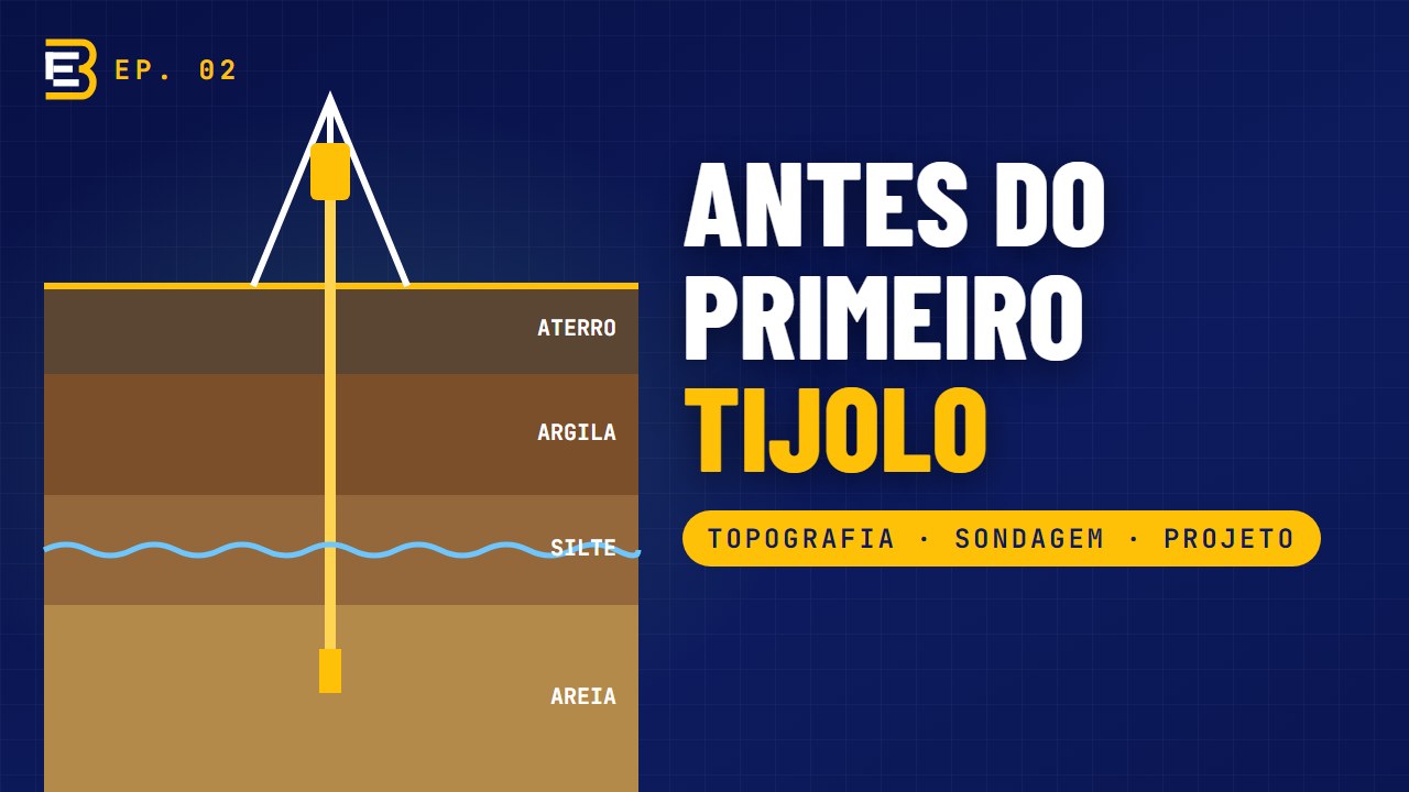
The most widely used test for buildings is the SPT, the simple reconnaissance boring carried out under the Brazilian standard ABNT NBR 6484. It works like this: a tripod is set up over the point, and a standard sampler is driven into the ground by a sixty-five-kilogram hammer that always falls from the same height, seventy-five centimetres. The team counts how many blows it takes for the sampler to penetrate the soil. That number, the penetration resistance index, is recorded metre by metre.
At the same time, the soil removed is classified (clay, silt, sand, fill), and the depth at which water appears is also noted.
The result is a log with the profile of each borehole. With it, the structural engineer chooses the type of foundation (footing, raft, pile or caisson) and defines the depth at which it will work, following the foundations standard, ABNT NBR 6122.
Without soil boring, the foundation is chosen by guesswork or, worse, by habit. Sometimes it ends up oversized, and you pay for concrete and steel you did not need. Sometimes it ends up undersized, and settlement, cracks and problems with only expensive solutions appear. The cost of soil boring is usually small compared with what it prevents.
The architectural design
With the plot known on paper, measured in the field and investigated underground, it is time for the architectural design. And here is why a ready-made design from the internet rarely works: it was not made for your plot, your city or your family.
- Needs programme: a good design starts with a conversation. How many people will live there, how many bedrooms, whether someone works from home, whether there will be a two-car garage, a gourmet area, the possibility of extending in the future.
- Preliminary study: the first ideas for arranging the rooms, already taking into account the position of the sun, the winds, the view and the slope of the plot. A living room facing the right way is brighter and cooler, and that costs nothing extra on site.
- Legal design: the version submitted to City Hall to obtain the building permit, following the parameters researched in the first stage.
- Construction design: all the details the site needs, such as dimensions, levels, windows and doors, sections, façades and specifications.
An important point: the architectural design is the basis of all the others. The structure and the installations are developed on top of it, which is the subject of the next episode.
Structure and retaining walls
A special case comes up often in our region: the sloping plot. When the difference in height is large, a retaining wall comes in, the structure that holds back the earth.
A retaining wall is not just a thicker ordinary wall. It is calculated to resist the push of the earth and of the water that builds up behind it. And water is precisely the biggest cause of problems. Without drainage, water accumulates, pressure increases and the wall tips over or cracks. That is why a well-designed retaining wall has drains, relief pipes known as weep holes, and a foundation sized from the soil boring.
The same reasoning applies to the structure of the house. The structural design defines the foundations, columns, beams and slabs, in reinforced concrete or steel, according to the technical standards. And it depends directly on everything we have seen: the survey, the soil boring and the architectural design.
Common mistakes
- Buying the plot without checking the title record and the legislation.
- Skipping the survey and trusting the measurements in the deed.
- Choosing the foundation without soil boring, because the neighbour did it that way.
- Using a ready-made design that does not suit the plot.
- Building a retaining wall without calculation and without drainage.
Frequently asked questions
What should be done before building on a plot?
Check the title record and the municipality's planning legislation, carry out the topographic survey and the soil boring and then produce an architectural design adapted to the plot.
What is a topographic and altimetric survey for?
To learn the real area and dimensions, the boundaries and the relief of the plot, position the building while respecting the setbacks and calculate cut and fill.
What is SPT soil boring?
It is the simple reconnaissance boring of the soil (ABNT NBR 6484), which measures penetration resistance and identifies the layers and the water table. It is the basis for choosing and sizing the foundation.
How many boreholes are needed?
It depends on the building's footprint and the characteristics of the plot; technical standards set the minimum number, and the engineer plans the boreholes for each case.
Why do retaining walls fall?
In most cases, because of a lack of calculation and drainage: water built up behind the wall greatly increases the pressure on it.
Is a ready-made design from the internet any use?
Rarely, because it does not consider the plot, the relief, the solar orientation or the city's legislation. For approval, it needs adaptation and a technical manager.
Are surveying and georeferencing the same thing?
No. Georeferencing is a survey tied to the official coordinate system, required in specific cases, such as rural properties.